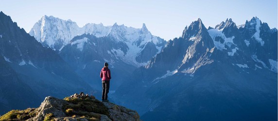
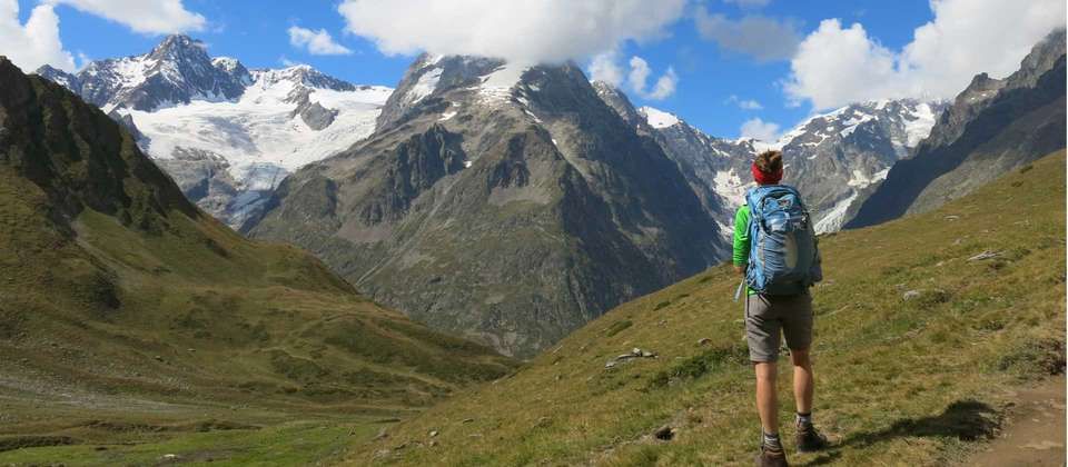
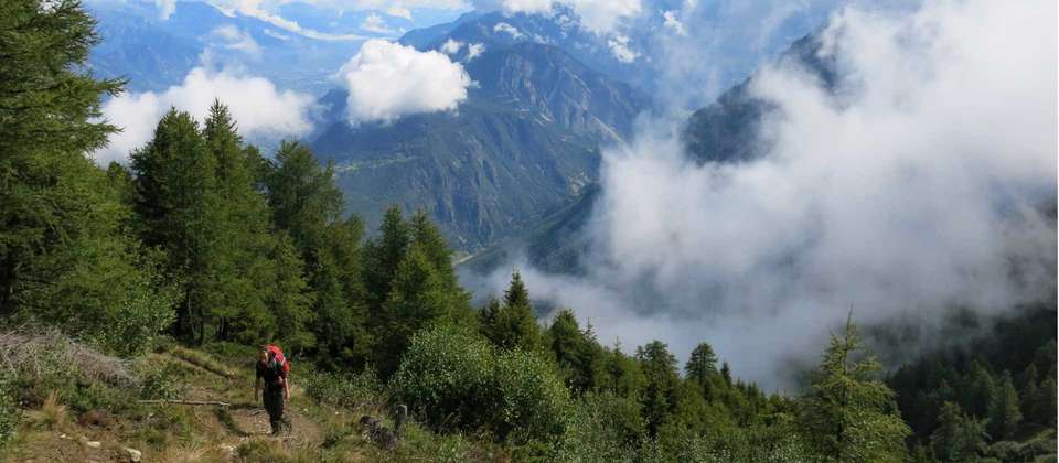
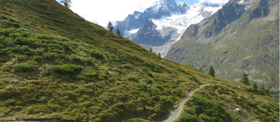
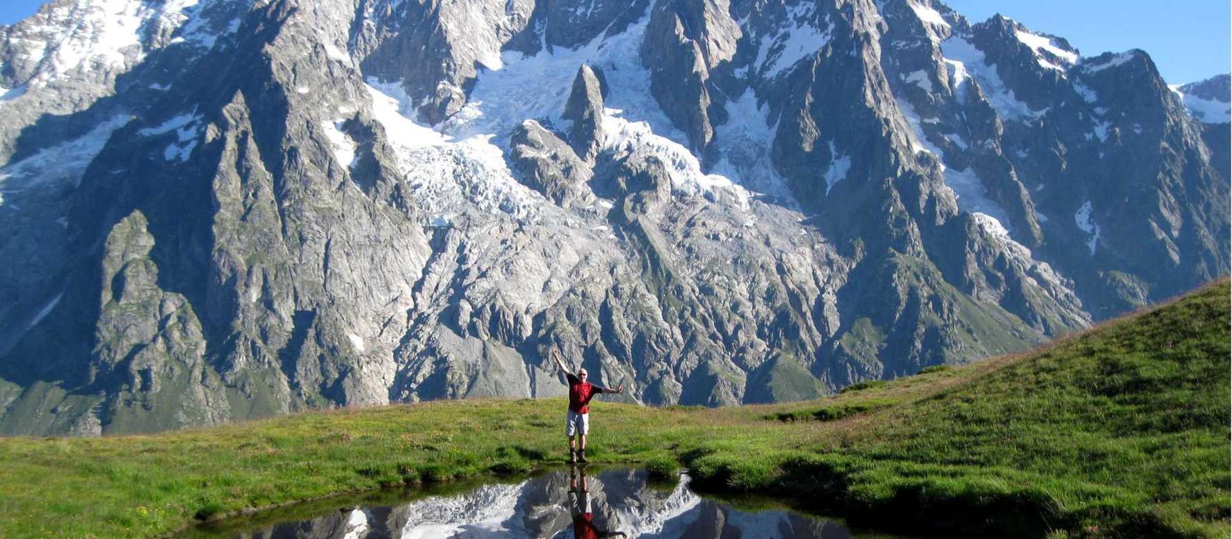
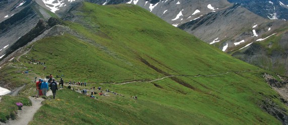
Circumnavigation of Mont Blanc
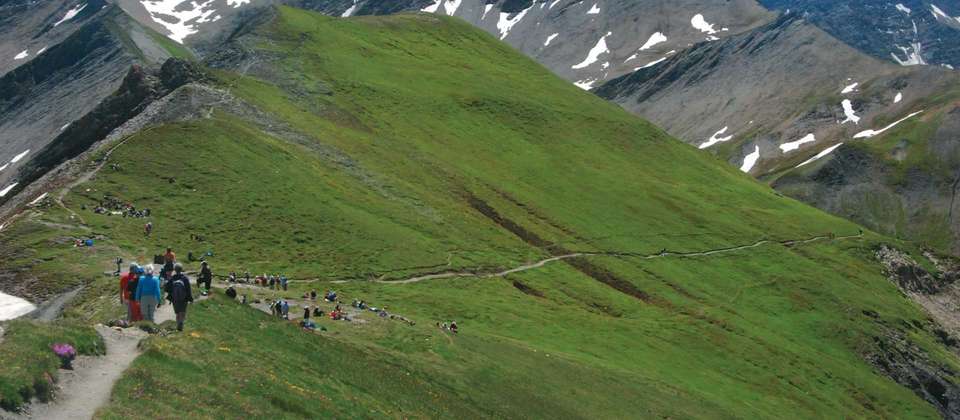
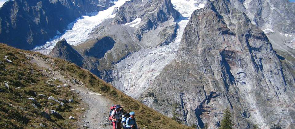
Experiencing the exhilaration of trekking in the European Alps
Traversing high passes and hiking through three countries
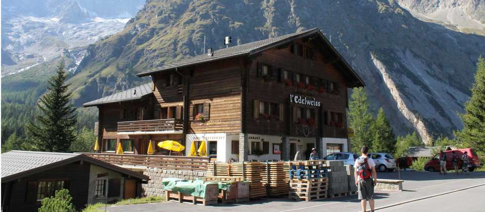
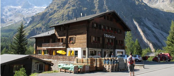
Enjoying the culinary specialties such as Raclette
Sharing stories with other hikers in the gîtes and mountain refuges

Download a detailed PDF brochure and unlock an exclusive discount for this tour
Select your preferred departure date and secure your spot
Loading availability...
If you have any question about this tour or need help with planning a trip, please do not hesitate to get in touch with us.
Our travel experts are ready to help.


Earn USD 70+ in travel credits.
Best price guaranteed.
No credit card or booking fees.
100% financial protection.
Carbon neutral tours.
25,000+ trip reviews, with an average rating of 4.8 out of 5.
Read what other travelers have to say about Mont Blanc Circuit Self Guided Hike
Our most popular self guided walk along the iconic circuit trail around Mont Blanc. This itinerary circumnavigates Mont Blanc and explores the surrounding alpine region. Faced with picture postcard vistas from every vantage point, the scenery and landscapes that unfold before you are simply remarkable. This trek affords unsurpassed views of the different faces of the Mont Blanc massif along routes that traverse the Balme mountain passage and the highest point on the Tour du Mont Blanc, the Grand Col Ferret at 2537m. You may see Ibex, chamois and other wildlife as you descend through alpine meadows towards charming fairy tale-like villages. Crossing the foothills of the Alps through France, Italy and Switzerland provides an opportunity to encounter the alpine cultures and cuisine unique to these areas and staying in hotels, gîtes and refuges is a great way to soak up the warm hospitality for which this region is renowned.
Leaving from Chamonix, take a balcony trail above Chamonix town. Heading up the valley the trail takes in the huge expanse of the Mont Blanc Massif, the Argentiere glacier and the Aiguille du Tour (3542m). It is an exhilarating hike and a fabulous start to the week. Overnight Le Tour.
Distance 13.3km/8.2mi, +870m/1476ft, -450m/1476ft
Leaving from Le Tour in the Chamonix valley, you take the scenic high mountain path of Balme heading towards Switzerland. Weather permitting you will be able to take some wonderful photos of the Mont Blanc chain including the impressive “La Verte”, the Drus and the Needles of Chamonix. You will cross the border between France and Switzerland before making your way down to the village of Trient for overnight accommodation or continue to the nearby Col de la Forclaz.
Distance 12km/7.5mi, +1050m/3445ft, -980m/3512ft
The trail continues through impressive forests with a strong ascent to the high mountain pastures of the Bovine Alps. The route takes you past shepherds huts and small farms always with views of impressive peaks such as Grand Combin to the south and later to the dramatic depths of the Rhone Valley. The Bovine hut is a great place to stop for lunch where you can spot Marmots playing in the slopes nearby. Descend along a forest trail to the pretty town of Champex located by the lake of the same name.
Distance 15.5km/9.5mi, +945m/3100ft, -900m/2952ft
An alternative route is via the “Fenêtre d'Arpette” (2665m), however due to the instability of this trail we do not recommend this route.
Although this is most definitely an easier day, it is also one that highlights some amazing natural beauty. Dry meadows, pools of fresh water, herds of cows and wonderful chalets surrounded by flower filled gardens greet us. Swiss village life is all around and whilst the dramatic scenery of previous days is not as apparent, it is a chance to experience the wonderful “Valais des homes”. Overnight in La Fouly.
Distance 15.4km/9.5mi, +750m/2460ft, -620m/2034ft
The route takes you out of Switzerland and into Italy by the Grand Col Ferret path. The sight of the Pre de Bar glacier is with you all the way as you make your way from the Col to the road head in the Val Ferret. Bus to Courmayeur.
Distance 13km/8mi, +1090m/3576ft, -930m/3051ft
This morning you will need to pack your overnight requirements for the next two nights in your daypack. Your main luggage will be waiting for you in Les Contamines on the afternoon of day 7.
From the centre of Courmayeur the hike heads steeply up a switchback trail to the Col Checroui. From here you continue the ascent to a steep spur at the top of the valley Veni where the views are spectacular. This balcony trail has some of the most dramatic views of the entire TMB trail. The descent is quite steep to the relatively flat valley floor. Skirting Lake Combal, the trail ascends at the head of the valley to the refuge.
Distance 15km/9.3mi, +1494m/4900ft, -630m/2067ft
Note: There are options to shorten by taking a bus in the event of poor weather or from around mid July to the end of August you can take a chairlift from Courmayeur (cutting out 700m of the ascent).
From the refuge Elisabetta, the trail takes you to the border of Italy and France at the Col de la Seigne (2518m) in time for an early morning view which, in good weather, will be extraordinary with sweeping views of the Mont Blanc massif and surrounding glaciers and valleys. Descend via a switchback trail to the Vallee des Glaciers, passing by a cheese maker where you have opportunities (if open) to sample Beaufort cheese. A big ascent (949m) through alpine meadows and over small streams leads to your overnight refuge just below the pass of Col de la Croix.
Distance 15km/9.3mi, +1300m/4265ft, -1000m/3280ft
This morning the trail traverses open mountain pastures to the Col du Bonhomme (2329m), with expansive views across to the peaks of the Beaufortain range. From the pass, the route descends into the Contamines-Montjoie Valley via the Contamines Nature Reserve. A steep section through a forested gorge leads to the historic Roman road and the chapel of Notre Dame de la Gorge. The trail then follows the valley floor through the alpine village of Les Contamines before climbing again through a series of small hamlets and meadows. Shortly before reaching the Miage Valley, you’ll pass the scenic chalets of Truc, offering sweeping views of the surrounding peaks. The day ends at the Refuge de Miage, nestled beneath dramatic glaciers in a tranquil alpine setting.
Distance 19km/11.8mi, +640m/2100ft, -1500m/4921ft
Note: Your main luggage will be waiting for you in your accommodation at your accommodation
From the Refuge de Miage, the main route (weather permitting) ascends to the Col du Tricot (2120m), which forms the divide between the Miage and Bionnassay valleys. The climb offers outstanding views of the Dômes de Miage behind you and, from the pass, panoramic views across to the tumbling glaciers of the Aiguille de Bionnassay. The descent traverses a hanging valley beneath limestone cliffs and follows gravel tracks past small alpine hamlets before climbing again to the Col de Voza, situated between the Aiguille de Bionnassay and the Aiguille du Goûter. From here, it is a steady descent to the village of Les Houches, where your trek concludes. You return to Chamonix by local bus or train to collect your luggage.
In poor weather, or if conditions are unsuitable, an alternative route may be taken via the river valley. This variant leads down to La Gruvaz, then gradually climbs through Le Champel and onto a steeper trail ascending via Bionnassay to reach the Col de Voza. This route offers fewer high mountain views but is a safe and scenic option in inclement conditions.
Distance 14km/8.7mi, +716m/2350ft, -1287m/4222ft
Alternate route via Le Champel -
Distance 17.5km/10.9mi, +788m/2585ft, -1352m/4436ft
Discover our top tours similar to Mont Blanc Circuit Self Guided Hike that you might like.
Fabulous scenery. Well organised trip.
A great trip, challenging, fabulous views, stunning wildflowers.
Good route, busy so so pleased accomm etc all booked in advance.
I broke my wrist at the end of the fourth day of TMB which is why I’m rating it as average. That’s not UTracks fault. UTracks were helpful while I was sorting out getting home and thankfully the overseas contact got my luggage to me. The app which we had was very useful when hiking. When prepping for the TMB UTracks was very helpful in helping me discover options if I didn’t want to walk each day of the hike.
We had an incredible trip in our self guided group of six people with all accomodation being organised appropriately and easy to find/check in when arriving each day after a long day of walking. We really enjoyed the variety of accomodation and food. Our bags arrived prior to our arrival almost every day, except one day when transferring from La Fouly to Courmayeur (which is the longest section to drive) where the bags arrived at 7pm. Apart from this minor delay (we just had a few more drinks while waiting!) everything went smoothly. I would recommend UTracks to friends based on our experience. I also found the UTracks online map clear and helpful, with good tips and waypoints along the track.