Highlights
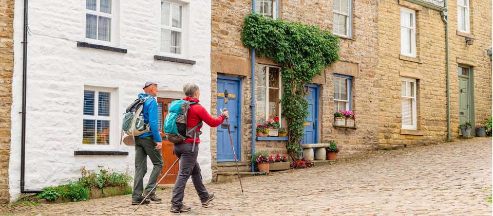
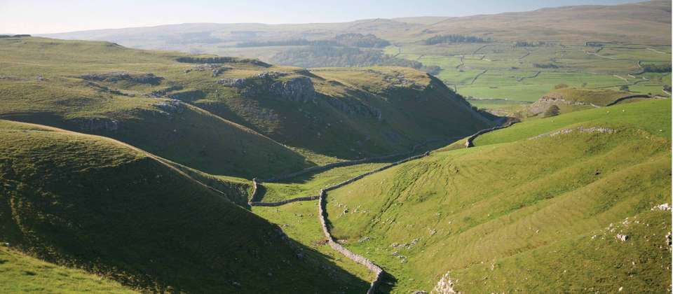
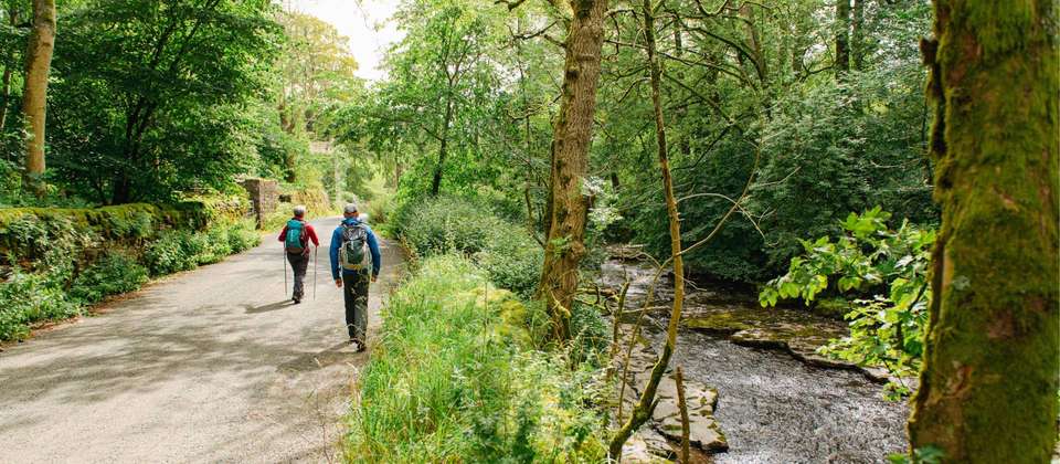
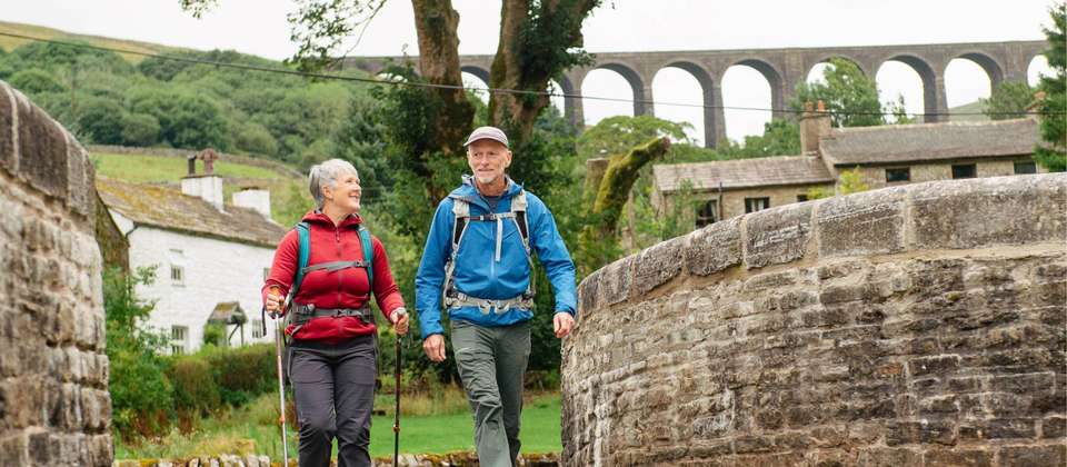
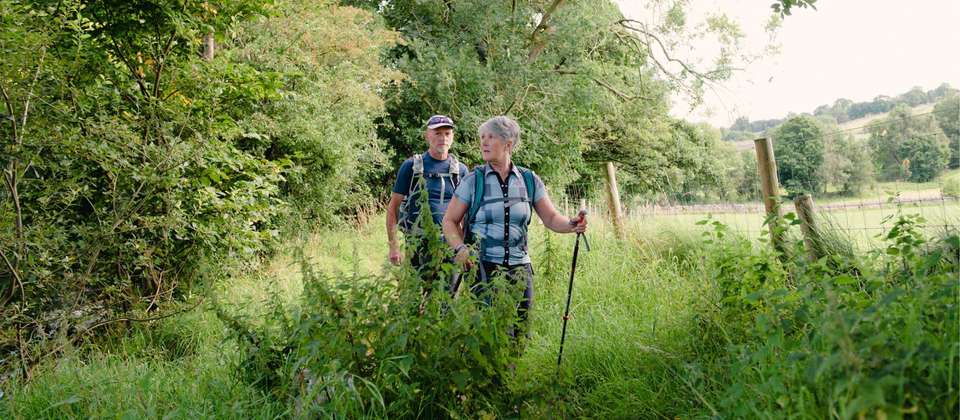
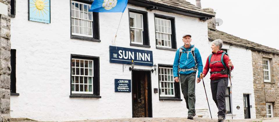
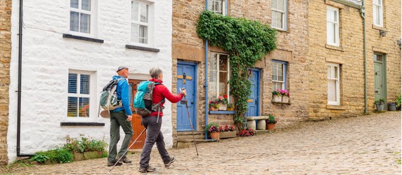
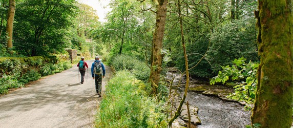
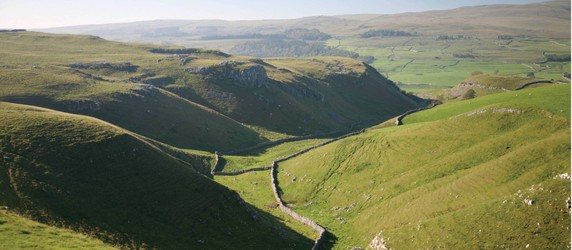
Hiking Through the Yorkshire Dales
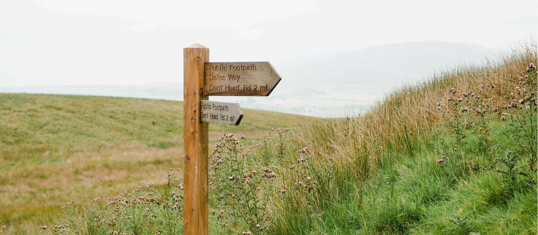
A 78 mile walk crossing the Pennines from Ilkley to Windermere
Walking Through Beautiful Wharfedale and Dentdale to the Lake District
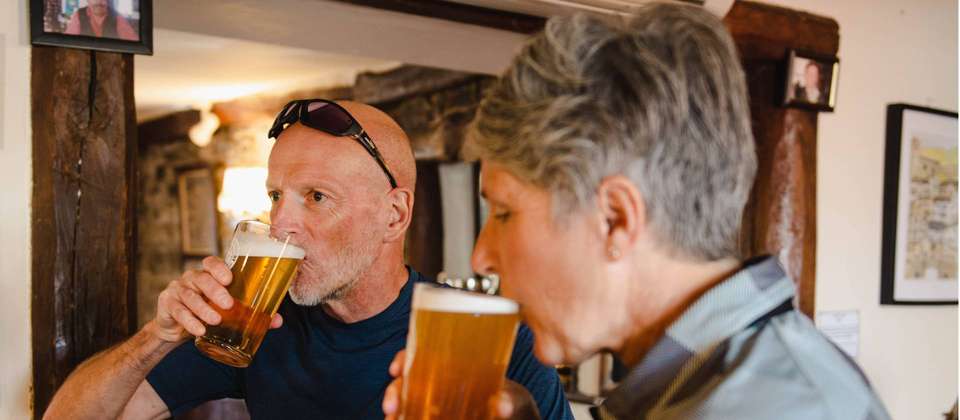
Stay in Inns and Farmhouses Dating from the 16th and 17th Centuries
Itinerary
The Dales Way - 10 Days invites experienced travelers and seniors to journey through the heart of the English countryside, from Ilkley to Bowness-on-Windermere. This moderate walking tour covers 78 miles of the Yorkshire Dales and Lake District, meandering through rolling hills, limestone valleys, and traditional villages. Along the way, you’ll encounter waterfalls, ancient churches, and welcoming pubs, with plenty of opportunities for birdwatching and picnics by scenic rivers. The route is celebrated for its gentle gradients and variety, offering a taste of England’s timeless rural charm. The unique feature of this trip is the opportunity to experience the full Dales Way, a beloved long-distance path, at a leisurely and enjoyable pace.
day 1 - Arrive Ilkley
Make your own way to Ilkley. Optional walk to Cow, Calf Rocks and Ilkley Moor. Here you can find the ‘White Well’ a tiny Victorian spa, not much bigger than a luxury sized bath, popular in the days when people with pneumonia were encouraged to bathe in icy cold waters. If the flag is flying, a small teashop is also open (2.5 hr round trip). If you prefer to relax have a look around this attractive country town with its range of specialist local family shops and cafes, there is a branch of Betty’s Tea Rooms with declicious cakes and a variety of teas. There is a small history museum and next to it, All Saints Church, which is built on the site of a Roman fort, contains some Anglo-Saxon crosses dating back to the 9th century.
day 2 - Ilkley to Burnsall 21.7 km/13.5 miles, 6 h
Lower Wharfedale and Bolton Abbey. This promises to be a very beautiful walk tracing the side of the River Wharfe. Undoubtedly, the well-preserved remains of Bolton Abbey are a popular spot especially on a weekend. To continue, you can cross to the other side of the Wharfe either by the bridge or by a long sequence of stepping stones. The route continues through the Duke of Devonshire’s estate and into beautiful Strid Woods, with a little gorge area - The Strid where the Wharfe narrows to a point that it has a cheese wire effect on the rocks incising a little gorge. From here the landscape opens up again as you head past the substantial structure of Barden Bridge. Thirsty people with a sensitivity for architecture, might like to take mile or so detour to the pretty village of Appletreewick which has an interesting ensemble of local stone houses as well as two nice pubs. Watch out for the weather stone, which can tell you the weather in any weather! There are a couple of interesting churches including St. Wilfrid’s from the 1400s.
day 3 - Burnsall to Kettlewell 16 km/10 miles, 5-6 h
Today is an upland and lowland day. Firstly follow the Wharfe past attractive Linton to the market town of Grassington, with is cobbled streets and teashops. The route then leaves the river to start heading across drystone wall fringed upland fields. There are great views over rocky scars, over dales and limestone pavements, before descending to reacquaint oneself with the river as you reach the old lead mining village of Kettlewell with three pretty looking pubs, this was the setting for the film ‘Calendar Girls’ filmed in 2003.
day 4 - Kettlewell to Hubberholme area 8.7km/5.5 miles 4 4.5 h
Rejoining the river, thread your way through sheepy fields to Buckden an even smaller village than Kettlewell. Rest on the green before following the Wharfe towards its upper youthful sections, the water spilling off limestone terraces and small waterfalls You will then arrive into Hubberholme with its attractive church and torrents. For those clients not staying at Hubberholme you will walk onto Yockenthwaite.
day 5 - Hubberholme area 26km/16 miles to Cowgill, 6-7 h
Say goodbye to the infant River Wharfe, you climb stiffly up and out of Wharfedale over Cam Fell. The farmland here can be boggy! A steep ascent from Cam houses, the last farm in the Dale, brings you to a broad track and the highest point of the walk 1710ft / 521m, then start descending along what was once a Roman road, cutting across the Pennine Way Footpath and down into Dentdale. Views hopefully of the Yorkshire three peaks; Penyghent, Whernside and Ingelborough. Walk down towards Ribblehead and then there is a further moorland section re-ascending slightly to cross over to Denthead and then you are confronted with the magnificent viaduct on the Settle to Carlisle Railway, which almost seems to be a natural part of the surroundings. Another mile of steep descent along the pretty River Dee, brings you to your Inn at Cowgill, a quiet pretty place, there are occasional cars, but you are more likely to be awoken by the sound of owls, sheep and the sparkling, splashing river.
Note: Due to a landslide in Jan 2025 a diversion off the main route between Hubberholme and Cowgill may be in place. Details provided with final documents.
day 6 - Cowgill to Sedbergh through Dentdale 16.6 km/11 miles, 5-6 h
An attractive valleyside and river crossing day through Dentdale to Sedbergh. At the foot of the steep Howgill Fells. The Dee becomes wider and more ‘fluid’ as you go. After about 4 miles there is a welcome diversion offered across the river in the village of Dent, built of grey limestone with cobbled streets and well protected traditionally maintained buildings, this was the birth place of Adam Sedgwick in 1785, an important geology professor who much influenced Charles Darwin later on. There are a couple of welcome tea shops and the George and Dragon pub serves ale crafted by the Dent Brewery only a couple of miles away. St. Andrew’s church has a beautiful interior. Following the river some more, ascend over a slight ridge and down into Garsdale and cross the river Rawthey and up steeply to the small town of Sedbergh at the foot of the wildly undulating Howgill Fells. Sedbergh is famous for its Public school and like Ilkey, has a number of family run shops. There are however, an overwhelming amount of bookshops, as it claims to be England’s book town, worth knowing if you are out of reading material by this stage of the walking tour!
day 7 - Sedbergh to Patton Bridge 22 km/13.7 miles, 6 h
You may wish to have a leisurely breakfast and depart Sedbergh later in the day exploring more of the village. Return to the River Rawthey, and follow this attractive river, before joining the River Lune walking past some more viaducts reflecting the glorious Victorian era of engineering. At Crook of Lune you will cross a beautiful parabolic arch bridge, which is probably 500 years old. The view from it towards the Howgill Fells is a beauty. The Way now follows across an undulating landscape of sheep pastureland, with views of the Howgills before reaching a couple of hamlets where we may stay.
day 8 - Patton Bridge to Staveley 14km / 8.7 miles 5 h
Now towards the Lake District. You will reach Black Moss Tarn, a tiny lake tucked into a fold of the meadows, often with swans and geese floating upon it. Then descend, meeting briefly the rivers Mint and Sprint and onwards towards the 14th century Burneside Hall, a Pele tower to protect inhabitants from the Scots and the ‘Border Reivers’ who caused mayhem in this land. Arriving at Burneside, the first realization is that this is an industrial rather than tourist village dominated by a paper mill relying on the waters of the River Kent. The oldest parts of this mill are worth having a look at, with its interesting clock tower. Burneside has a small shop for snacks, or the pub may be open for a drink. Then follow the attractive River Kent to Staveley passing interesting former mill areas, which in some cases have been creatively redeveloped into housing. The millponds however still remain and often trout can be seen jumping for fly. A few miles bring you into Staveley, an attractive village with coffee shops, a brewery, outdoor shops and an interesting bell tower.
day 9 - Staveley to Bowness on Windermere 10.6 km/6.5 miles, 3 h
The walk becomes increasingly rural and then onto wilder areas with heather and bracken clad hills. On a good day a short diversion up to School Knott will reveal a great Lakeland panorama including the Coniston Fells, Crinkle Crags and Scafell. Then you descend towards Lake Windermere, which remains elusive until you finally leave woodland, and descend into Bowness on Windermere, a tourist town on the lakeside, this expanse of water is England's largest natural lake.
day 10 - Arrangements end after breakfast
After breakfast, make your way to the train station for your onward journey.

Get Trip Brochure & Exclusive Discount
Download a detailed PDF brochure and unlock an exclusive discount for this tour
What's Included
What's Excluded
Tour Availability
Select your preferred departure date and secure your spot
Loading availability...
Monthly Price Comparison
Good to Know
Do you need help from our trip consultants?
If you have any question about this tour or need help with planning a trip, please do not hesitate to get in touch with us.
Our travel experts are ready to help.


Why Book with Bookmundi
Earn USD 79+ in travel credits.
Best price guaranteed.
No credit card or booking fees.
100% financial protection.
Carbon neutral tours.
25,000+ trip reviews, with an average rating of 4.8 out of 5.


