10 Mighty Indonesian Volcanos to Hike: Ready for the Challenge?


Indonesia is a country known for many things such as its pristine beaches and delicious food. What many people don't realize is that Indonesia actually has more volcanoes than anywhere else in the world! Home to the "Ring of Fire", an area in the Pacific Ocean where many earthquakes and volcanic eruptions occur, there are thought to be 150 volcanoes in Indonesia alone.
Some volcanoes in Indonesia are active while others are not, the latter being perfect for hiking or trekking. To find out which ones are most worth visiting, we've put together this list for you, in no particular order.

- Luca Sagerer
- From Austria
- Luca Sagerer
- From Austria
- Fleur Van Dooren
- From Netherlands
- Victoria Luisa Marsiaj
- From Switzerland
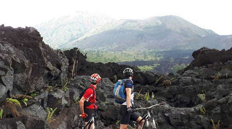
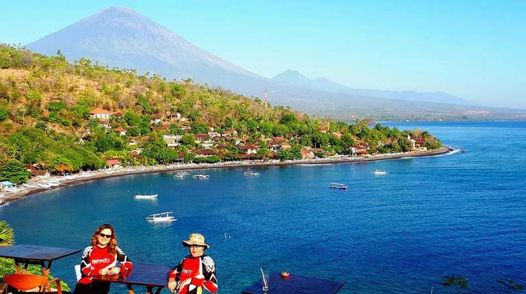
1. Mount Agung
You must have heard of Mount Agung (pictured above), particularly due to its recent eruption that caused some travel delays and complications on the popular tourist island of Bali. Mount Agung is the tallest point on Bali and is considered the most sacred mountain on the island. It is also a very popular hiking trail in Bali for more experienced hikers and can be scaled in about 6 or 7 hours with the help of a guide. A highlight of this volcano is the stunning Besakih Temple, or the Mother Temple, Bali's largest temple on the volcano's southern slopes.
- Location: Eastern Bali
- Height: 3142 m
- Last erupted: 13 June 2019
- Status: Active
Highlights
- Seeing the beautiful sunrise from the top of the mountain
- Visiting the stunning Mother Temple of Besakih
- Far less crowds than other sunrise hikes, including Mount Batur
Lowlights
- The temple in Pura Pasar Agung is sometimes closed for ceremonies, so check in advance if you wish to visit
- This is a strenuous, tough climb and is mostly done in the dark (though worth it at the end!)
- You must get up very early if you wish to see the sunrise, leaving the starting point around midnight
| Mount Agung Hike Facts | |
|---|---|
| Hike duration: | 4–5 hours from Pura Pasar Agung, 6–7 hours from Besakih |
| Hike difficulty / physical fitness: | Strenuous. High level of fitness required, recommended for experienced hikers only. |
| Remoteness: | Somewhat remote. 2–3 hours drive from Besakih, 20 km north of Klunkung |
| Best season: | Dry season (April to October) though the routes are often closed in April for religious ceremonies |
| Start and end locations: | From the Pasar Agung Temple in Puru Pasar Agung (in the South) to the Crater Rim; or a slightly longer trek from Besakih (in the west) to the summit |
| Permits required: | Anywhere from IDR 400,000 (USD 30) to IDR 1,000,000 (USD 74) for your guide, including your hiking permit |
| What to bring: | Flashlight, walking shoes with good grip, a walking stick, warm layers of clothing (including gloves), sunscreen, water and some breakfast |
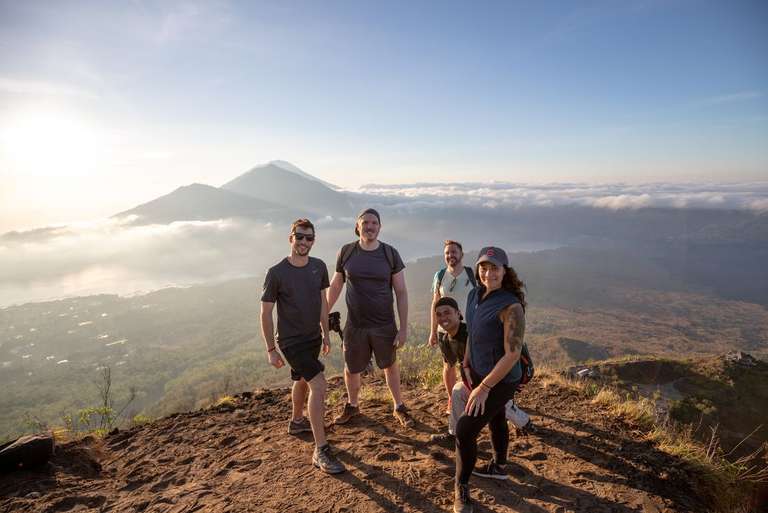
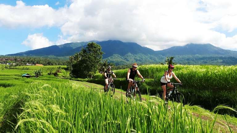
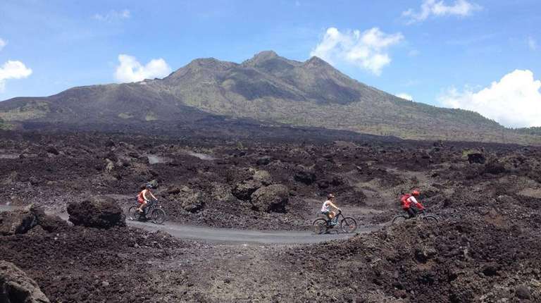
2. Mount Batur

Mount Batur is probably one of Indonesia's most popular volcanoes due to its difficult but rewarding hike. Most people chose to do the two-to-three-hour hike of Mount Batur at dawn so they can see the incredible sunrise from the top. It is one of the most popular activities on the island of Bali for those looking for a bit of adventure. This Indonesian volcano is located in a beautiful sprawling caldera and is twinned by Mount Abang on the other side.
- Location: North Eastern Bali, not far from Ubud
- Height: 1717 m
- Last erupted: 25 March 2011
- Status: No activity since its last eruption
Please read our guide to hiking Mount Batur for more detailed information.

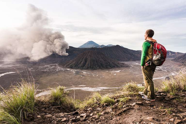
3. Mount Bromo

If you're looking for an Indonesian volcano with a view, Mount Bromo is the one for you. Located within the Tenger Caldera, one of the most scenic locations in all of Indonesia, Mount Bromo offers incredible views of the sunrise with nearby Mount Semeru (featured below on this list) standing in the background. You don't even have to hike the volcano in order to see the view — you can also drive part way up the mountain and then ride a horse up to the top. There is a small set of stairs that you then must climb to reach the crater.
- Location: East Java
- Height: 2329 m
- Last erupted: 11 November 2016
- Status: Minor activity since the last eruption
Highlights
- Gorgeous sunrise views with other volcanoes in the background
- Not a very difficult hike
Lowlights
- Waking up early to see the sunrise (usually around 3:30 am)
- Dealing with very cold temperatures in the dark
- Checkpoint 2 on the hike is accessible by car, so you may have to share it with crowds
| Mount Bromo Hike Facts | |
|---|---|
| Hike duration: | About 1–2 hours |
| Hike difficulty / physical fitness: | Easy. Fit for all hikers. |
| Remoteness: |
Fairly remote, closest town is Probolinggo, 27 miles away (about 3 hours away from Surabaya) accessible by public transport, but arranging private transport is recommended |
| Best season: | Dry season (April to October) |
| Start and end locations: | From Cemoro Lawang village to the rim |
| Permits required: | Park entrance fee of IDR 217,500 (USD 16) on weekdays and IDR 320,000 (USD 24) on weekends |
| What to bring: | Flashlight, water, warm clothing |
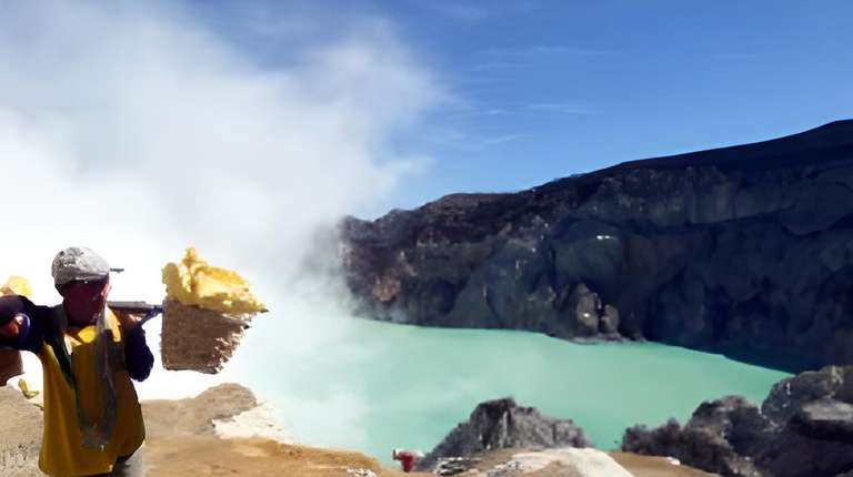
4. Mount Ijen

Mount Ijen is most well-known for its impressive crater, Kawah Ijen, where visitors get to experience a turquoise-coloured sulphuric lake inside. At night, the volcano gives off some pretty impressive blue sulphur flames — well worth the night-time hike to see. This is the largest acidic volcanic lake in the world, and sulphur collectors come to Mount Ijen every day to collect the mineral while being exposed to some pretty harmful fumes.
- Location: East Java
- Height: 2799 m
- Last erupted: 4 June 2016
- Status: No activity since the last eruption
Highlights
- Seeing the beautiful turquoise-coloured lake at the top
- Watching the blue flames leap up from the crater at night
- One of the most spectacular sunrises in all of Indonesia
Lowlights
- Hiking in the dark and the cold
- Having to wake up early (around 2:30 am) if you want to see the flame
- Strong sulphur smell at the top (you’ll want to wear a gas mask)
| Mount Ijen Hike Facts | |
|---|---|
| Hike duration: | About 1–2 hours |
| Hike difficulty / physical fitness: | Challenging, particularly near the crater. Not recommended for those with breathing issues due to sulphur. |
| Remoteness: | Somewhat remote, about 1 hour 15 minutes from Banyuwangi |
| Best season: | Dry season (April to October) |
| Start and end locations: | Entrance at the mountain’s base camp (opens at 2:30am) to the caldera rim. This is a linear trail. |
| Permits required: | 150,000 IDR (USD 11.25) |
| What to bring: | Gas mask (ask your guide if it’s provided), flashlight, shoes with good grip, warm clothes, water, walking stick |
5. Mount Kerinci

Well, this is the big one! Mount Kerinci is the highest Indonesian volcano, towering over the island of Sumatra at 3805 m. It lies in the Kerinci Seblat National Park. On a clear day, you can see all the surrounding cities and even the Indian Ocean from its summit. At the summit, you will also find a large crater filled with green-coloured water and Bento Lake.
Mount Kerinci is also home to a wild abundance of wildlife, including the endangered Sumatran rhino and the Sumatran tiger. Due to the recent high levels of volcanic activity at Mount Kerinci, there is a 1 km wide exclusion zone around it but it should not be a worry as long as you stick to the trail.
- Location: West Sumatra
- Height: 3805 m
- Last erupted: 13 August 2017
- Status: Minor activity
- Entrance fee: IDR 15000 (USD 1.1) for entering the Kerinci Seblat National Park
Highlights
- Spectacular views of the surrounding area from the summit
- Diverse landscapes and wildlife, all the way up to the top
- Climbing the highest active volcano in Southeast Asia
Lowlights
- Camping on the mountains where nights can be cold with an early start each day (although some may argue that this makes for a more authentic hiking/trekking experience)
- You may not always be permitted to reach the summit, as the volcano is still active (your guide will typically advise as you get closer)
| Mount Kerinci Hike Facts | |
|---|---|
| Hike duration: | 2 – 3 days |
| Hike difficulty / Physical fitness: | Challenging. This hike is for people who wish to challenge their stamina. |
| Remoteness: | Very remote. The nearest town is Kersik Tuo. Most travel from Padang (West Sumatra), some 8–10 hours away by car |
| Best season: | Dry season (April to October). Mount Kerinci is in a rainforest, so be prepared for some rain and slippery trails. |
| Start and end locations: | Kersik Tua tea plantations to the summit |
| Permits required: | IDR 150,000 (USD 11.25) |
| What to bring: | Waterproof hiking shoes, warm clothing that covers most of your body, a headlamp or flashlight, a waterproof jacket, sunscreen, camping gear (should be provided by your guide) |
6. Mount Krakatau / Anak Krakatau
.")
If you ask most people to name a volcano, they will probably name Mount Krakatua (or Krakatau). This may very well be the most famous volcano in the entire world, thanks to its massive explosion in 1883. The eruption was so powerful it was felt all the way in Sydney, Australia (some 4,000+ km away) and it even caused the volcano to break apart, so that it now grows in size every year and has even created other smaller volcanos. While you cannot hike this dangerous volcano, you can visit one of those 'baby' volcanos: Anak Krakatau, which can be reached in about an hour by speedboat from Cerita Beach (two hours from Jakarta).
- Location: Sunda Strait, between Java and Sumatra
- Height: 813 m
- Last erupted: 10 April 2020
- Status: Minor activity
- Hiking Mount Krakatau: No
Highlights
- Spend the night on the beach at the base of the volcano
- Seeing the other fragments of the Krakatau volcano around you
- Look out for marine life (like dolphins) on your boat ride over to Anak Krakatau
Lowlights
- You cannot reach the summit, only a viewpoint about halfway up the volcano (if you go higher it is too hot)
- Must take a boat in order to reach the volcano
| Anak Krakatau Hike Facts | |
|---|---|
| Hike duration: | 30 minutes |
| Hike difficulty: | Easy |
| Remoteness: | Somewhat remote — 1 hour by speedboat from Cerita Beach |
| Best season: | Dry season (April to October) |
| Start and end locations: | Cerita Beach at the island volcano’s base to the viewpoint (200 m above sea level) |
| Permits required: | None |
| What to bring: | Good walking shoes |
7. Mount Merapi

Mount Merapi, or "the mountain of fire" in the local language, is one of the most active Indonesian volcanoes; however, it has quieted down in recent years and can now sometimes be hiked when activity is low. Sometimes you can even arrange a nighttime flight over the volcano so that you can see the lava flowing down its eastern side. If you visit Mount Merapi, you can also see some of the ruins that were formed following the volcano's last large eruption in 2010.
- Location: Central Java
- Height: 2968 m
- Last erupted: 21 June 2020
- Status: Minor activity
Highlights
- Walking through the volcanic ash and seeing the ruins from the volcano’s most recent large eruption
- Seeing no less than 5 volcanoes from the summit on a clear day: Merapi, Merbabu, Sumbing, Sindoro and Telomoyo
Lowlights
- There are many obstacles on the path up and down the mountain, so you must be very careful not to injure yourself
- This is still a fairly dangerous volcano to hike, and you often won’t be able to get too close to the crater
| Mount Merapi Hike Facts | |
|---|---|
| Hike duration: | 4 – 6 hours |
| Hike difficulty / physical fitness: | Challenging at times, average level of fitness required |
| Remoteness: | Not very remote, not far from the village of Selo, or just 45 minutes from Yogyakarta |
| Best season: | Dry season (April to October) |
| Start and end locations: | Selo village to the summit (as close as you can get), the alternative route from Kaliurang is currently closed |
| Permits required: | Yes. IDR 150,000 (USD 11.25) during the week and IDR 225,000 (USD 16.61) on the weekend |
| What to bring: | Water, shoes with good grip, a flashlight and warm clothing if you hike at night |
8. Mount Rinjani

Mount Rinjani is the only volcano on the island of Lombok and is also the second highest volcano in Indonesia. Every year, there are many pilgrims who make the climb to the lush crater lake Segara Anak to make offerings to the gods. While it is certainly hike-able, the demanding trek takes about two days (though the views from the top are absolutely worth it). You can also take some shorter hikes among the hills on the mountain's slopes. As Lombok becomes a popular alternative island to Bali, more and more people are visiting Mount Rinjani.
Please read our guide on trekking Mount Rinjani for more detailed information.
- Location: North Eastern Lombok
- Height: 3726 m
- Last erupted: 27 September 2016
- Status: Dormant
Highlights
- Magnificent views from the top — the best in all of Lombok
- Seeing some spectacular landscapes, including a lush floral valley near the top
- Looking down into the crater to see turquoise Lake Segara Anak
Lowlights
- One of the most challenging hikes in Indonesia with a very slow pace due to its steepness
- Very cold weather, particularly at night
| Mount Rinjani Hike Facts | |
|---|---|
| Hike duration: | 2–6 days (depending on your tour/guide) |
| Hike difficulty / physical fitness: | Challenging — hikers should have stamina |
| Remoteness: | Not remote, many villages nearby |
| Best season: | Dry season (April to October) |
| Start and end locations: | Sembalun village to the crater (recommended), or Senaru village to the crater |
| Permits required: | 150,000 IDR (USD 11.65) per day |
| What to bring: | Warm clothing (including hats and gloves), good hiking shoes, sunscreen, water, food (check with your guide to see what is included), camping gear (if not provided), headlamps or flashlights, a walking stick |
If you are interested to hike Mount Bromo, Mount Rinjani and Mount Merbabu, another volcano adjacent to Mount Merapi, then the Indonesia Volcano Trek is for you.
9. Mount Semeru
You would be hard-pressed to find a volcano more diverse than Mount Semeru, the highest volcano on the island of Java, situated next to Mount Bromo. It is often called 'Mahameru' by the locals, which means 'the great mountain' and lets out a huge cloud of steam or smoke every 20 minutes or so. This stratovolcano is covered in a sprawling savanna and even features a freshwater lake and a field of Brazilian verbena (delicate purple flower) near the top. Hiking Mount Semeru is relatively easy, except for a slightly challenging slope near the summit, however, it would take you about two days to climb it in full.
- Location: East Java
- Height: 3676 m
- Last erupted: Continuous eruption since 1967
- Status: Active
Highlights
- Seeing many different landscapes as you ascend
- Watching the volcano emit a belch of smoke every 20 minutes
- Spending the night at the campsite on Lake Ranukumbolo
Lowlights
- Strong sulphur air near the crater
- Can be very rocky and difficult in some areas
| Mount Semeru Hike Facts | |
|---|---|
| Hike duration: | 2 days |
| Hike difficulty / physical fitness: | Not too challenging, but average level of fitness and stamina required due to duration |
| Remoteness: | Not very remote. Ranupane (the starting point) can be easily reached from nearby villages, such as Malang or Tumpang |
| Best season: | Dry season (April to October) |
| Start and end locations: | Ranupane village to the summit |
| Permits required: | 20,000 IDR (USD 2.10) |
| What to bring: | A copy of your passport (required by the park rangers), good hiking shoes, camping gear, water, food, hiking stick, headlamp or flashlight, waterproof clothing |
10. Mount Tambora
While the eruption of Mount Krakatoa may be quite famous around the world, it was, in fact, the 1815 eruption of Mount Tambora that was one of the deadliest in the world — the largest volcanic explosion ever recorded. It was the cause of the "Year without Summer" in 1816 — a series of climate abnormalities that caused temperatures to drop and led to major food shortages around the world. The eruption was believed to kill about 71,000 people and was heard over 2,000 km away. Today, the volcano is calm and safe to hike.
- Location: Sumbawa, West Nusa Tenggara
- Height: 2850 m
- Last erupted: 1967
- Status: Dormant
Highlights
- Uncrowded trail due to few hikers
- Discovering the archaeological sites at Tambora village, which was totally wiped out in the 1815 eruption
Lowlights
- Trying to find the volcano, as it is very remote
- Having to walk through a virgin jungle with many paths overgrown
- Dealing with the heavy rain (which is common in this area)
| Mount Tambora Hike Facts | |
|---|---|
| Hike duration: | 2–3 days (with an additional 3 if you wish to reach the summit) |
| Hike difficulty / physical fitness: | Challenging, high level of fitness required |
| Remoteness: | Very remote |
| Best season: | Dry season (April to October) |
| Start and end locations: | Pancasila village (can take more than a day to reach from Sumbawa Besar) to the summit; alternative route available from Doro Peti (near Dompu), but often overgrown. A local guide is highly recommended. |
| Permits required: | IDR 150,000 (USD 11.25) |
| What to bring: | Warm waterproof clothing, good hiking shoes, headlamp or flashlight, rainproof jacket |
It’s no wonder that with about 13% of the world’s volcanos, there are so many Indonesian volcanoes that you can explore. Conquering any of these mighty giants is an ode to one’s endurance and determination. These mountains call to some of the most adventurous spirits, are you up for the challenge?