The Laugavegur Trail Travel Guide


- Fleur Elliott
- From
- Fleur Elliott
- From
- Sally Campbell
- From
- Carly J
- From
HOW TO GET TO THE LAUGAVEGUR TRAILHEAD

To reach the Laugavegur trailhead in Landmannalaugar, there are a few options to consider, particularly during summer. However, it's crucial to assess the conditions and suitability of your vehicle before proceeding.
There are three main roads to Landmannalaugar. The easiest and most popular route is F208 from the north. The second most straightforward option is the F225 from the west, near Mount Hekla. The third and most challenging (yet incredibly scenic) route is F208 from the south, directly entering from the Ring Road.
Due to the rocky terrain, all three mountain roads (f-roads) leading to Landmannalaugar can only be accessed by 4×4 vehicles. So, If you're renting a car for a self-drive trip to the trailhead, ensure that you choose a 4×4 vehicle. And if you're traveling in a large group, taking a bus is the most convenient option. Buses operate around once a day from Reykjavik to Landmannalaugar and then return from Thórsmörk to Reykjavik. These buses provide a reliable transportation choice for hikers. Keep in mind that the start date of bus operations depends on the weather conditions.
STANDARD ITINERARY FOR TREKKING THE LAUGAVEGUR TRAIL
Below is a 4-day standard itinerary for a standard Laugavegur trek.

- Day 1: Landmannalaugar to Hrafntinnusker (4 to 5 hours)
Distance: 12km
Elevation Gain (Ascent): 470m
Leaving the hut in Landmannalaugar, follow the trail across the Laugahraun (a rocky, black lava field) before climbing up the colorful slopes of the Brennisteinsalda volcano. Walking across its plateau for about three to four hours, you will eventually reach the Stórihver hot springs, where you can stop and relax. Then, head to Höskuldsskáli hut. The path to this hut, where you will stop for the night, will likely be covered in snow but should be clearly marked. - Day 2: Hrafntinnusker to Álftavatn ( 4 to 5 hours )
Distance: 12 km
Elevation Gain (Ascent): 490m/1,610 ft
As you begin your second day, follow the trail through a valley with some small ravines. You will notice a sudden change in scenery, leaving the colorful rhyolite mountains behind for darker palagonite mountains, glaciers, and some green vegetation. As you head down through Jökultungur, the green grazing area, the path becomes steeper and eventually leads to the river Grashagakvísl. After passing the river, follow the trail until you reach the huts at Lake Álftavatn. - Day 3: Álftavatn to Emstrur (6 to 7 hours)
Distance: 15km
Elevation Loss (Descent): 40m / 130 ft
Today involves a bit more walking than the previous two days. Follow the trail over the Brattháls ridge into the ravine below, where you will cross the Bratthálskvísl River. Walking further, you will come across another river, Kaldaklofskvísl. On the river’s eastern side, the trail branches eastwards and southwards. For this itinerary, we follow the southward trail towards Emstrur. After about one kilometer of the hike, you will have to wade through another river, followed by a bridge crossing about four kilometers away, across the Nyrðri Emstruá. From there, you should be able to see the huts at Botnar. Take a break before venturing out to the Markarfljótsgljúfur canyon in the evening. - Day 4: Emstrur to Thórsmörk (6 to 7 hours)
Distance: 15km
Elevation Loss (Descent): 300m/985ft
Before heading out on your final day, walk around the Syðri-Emstruá river canyon before carefully treading the steep path to the bridge. From here, you cross an area called Almenningar, where the desert landscape will suddenly shift to plants and birch trees. After crossing the Þröngá River, the deepest river you will face on this trek, you are just 30 minutes away from the huts of Thórsmörk.
If you feel really adventurous, combine this itinerary with theFimmvörðuháls hiking trail and add a 25km section to your trek. It will take you from Thórsmörk to Skogar. This hike will take you at least 10 hours and is best tackled over a day or two. This part of the trail is scattered with hot springs, ending with incredible views of theMyrdalsjokull Glacier and Eyjafjallajokull Glacier.
WHEN IS THE BEST TIME FOR THE LAUGAVEGUR TREK?

The best time to hike the Laugavegur trail is during the summer months, from late June to early September. This period offers favorable weather conditions and longer daylight hours, ensuring a safer and more enjoyable hiking experience.
During summer, temperatures are milder, ranging from 10°C to 15°C (50°F to 59°F). However, keep in mind that Icelandic weather can be unpredictable, even in summer, with the possibility of rain, wind, or snow at higher elevations.
It's also worth noting that the trail is very popular and sees increased crowds during the peak season. So if you prefer a quieter experience, consider hiking during the shoulder months of June or September, when the trail is less crowded but still accessible.
For those seeking solitude, April, early June, and the months between October and November are ideal. However, keep in mind that the huts along the trail are closed from mid-June to mid-September, so you have to camp.
LAUGAVEGUR TRAIL FACTS

- Distance: The Laugavegur trail covers a distance of approximately 55 kilometers (34 miles) from Landmannalaugar to Thórsmörk. This distance can vary slightly depending on the specific route taken, and any optional detours hikers choose to explore along the way.
- Duration: Completing the entire Laugavegur trail usually takes hikers around four to five days. However, the duration can vary based on individual fitness level, hiking experience, and weather conditions. Some hikers may choose to extend their journey by incorporating additional side trips or rest days at certain locations to fully enjoy the stunning landscapes.
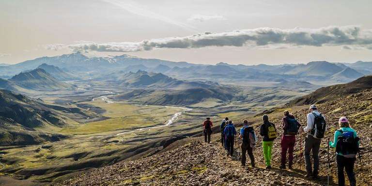
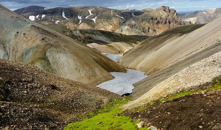
- Landscapes: One of the most captivating aspects of the Laugavegur trail is the diverse range of landscapes it traverses. Hikers will encounter vibrant mountainsides adorned with hues of red, yellow, green, and orange due to the presence of rhyolite rock formations. Glacial rivers, originating from the nearby glaciers, cut through the valleys, creating awe-inspiring scenes. The trail also leads through geothermal areas with active steam vents, hot springs, and bubbling mud pots, offering a surreal experience amidst the rugged Icelandic wilderness. Attractions such as the glacial volcano known as Eyjafjallajökull and mountains such as the Fimmvörðuháls provide stunning panoramic vistas on the route.
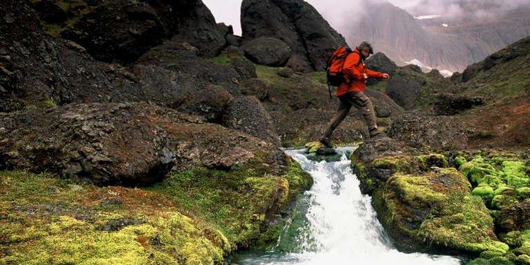
- River Crossings: The Laugavegur trail involves several river crossings, which can be one of the more challenging aspects of the hike. The Krossá River is a notable crossing point, and its depth and flow can vary depending on the time of year and recent weather conditions. Hikers must exercise caution and evaluate the river's conditions before attempting a crossing. It is advisable to consult experienced hikers, follow marked routes or cairns, and consider using hiking poles for stability. In some cases, it may be necessary to remove footwear and wade through the river, while in others, hikers may need to wait for a 4WD vehicle to provide a lift across.
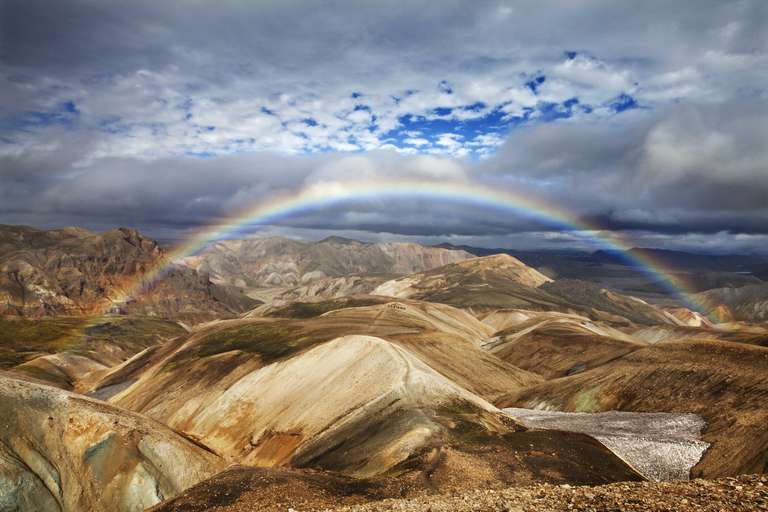
- Weather and Conditions: The weather along the Laugavegur trail can be highly unpredictable. Even during the summer months, hikers can encounter a range of weather conditions, including rain, snow, fog, and strong winds. It is essential to prepare for varying temperatures and pack appropriate clothing layers to adapt to the changing weather. Waterproof gear, sturdy hiking boots, warm clothing, and a reliable tent are recommended to ensure comfort and safety throughout the journey. Checking the weather forecast before starting each day's hike and being prepared for potential weather shifts is essential.
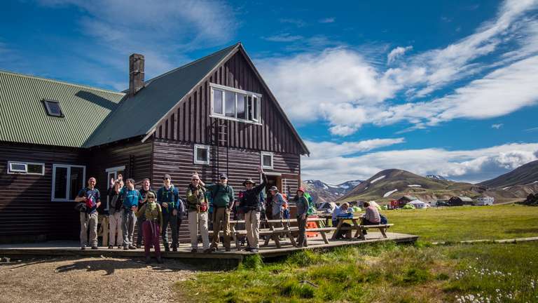
- Hut Accommodations: Along the Laugavegur trail, hikers have the option to stay in mountain huts provided by Ferðafélag Íslands (Iceland Touring Association). These huts offer basic amenities, including sleeping quarters, communal cooking areas, and restroom facilities. However, due to the popularity of the trail, it is crucial to book hut accommodations well in advance, as they can fill up quickly. Each hut has a limited capacity, and beds are typically shared among multiple hikers, with bunk beds accommodating two or more people. Campers, on the other hand, can find designated camping areas near the huts, although they must bring their own camping gear and cooking equipment.
WHAT TO BRING AND WEAR
- Be sure to bring battery power banks to charge your mobile phones and cameras because there is no access to electricity on the trail, except at Thórsmörk.
- Mobile coverage is available in some places but limited in other sections of the trail. Be sure to bring your own food along with you, as there is only a single shop along the way (in Landmannalaugar) and it can be very expensive.
- Bring a water bottle, which you can refill in rivers along the way.
- Pack layers and waterproof gear in case of a sudden weather change, which is fairly common.
Hiking boots are essential. - Sleeping bags are not provided at all huts, so it is best to bring one with you. Read our detailed guide on the equipment needed while trekking for more information.
SAFETY TIPS
- Hiking the Laugavegur trail requires careful safety preparations. Before embarking on the trip, hikers must register at the information hut in Landmannalaugar and provide details about their hiking plans, including the expected route, dates, and estimated arrival time at Thórsmörk. This information helps authorities monitor hikers’ safety and can be crucial in case of emergencies.
- Carrying a detailed map and compass for navigation, as mobile phone coverage may be limited or unavailable in certain areas of the trail.
- Pack a well-stocked first aid kit, sufficient food, and water supplies for the duration of the hike.
- Visiting the SafeTravel website for updated information, including weather forecasts, trail conditions, and safety guidelines, is highly recommended.
- Interact with the wardens at the information office of each hut and utilize online resources to stay updated. Having a thorough understanding of potential hazards or challenges along the trail will help you make informed decisions and adjust your plans accordingly.
- If you're not an experienced camper or prefer a lighter load, consider staying in the accommodation huts along the trail. These huts provide a comfortable and sheltered option for hikers.
- If you decide to camp, it is crucial to pitch your tent only in designated campsites. These campsites are specifically designed to protect the delicate Icelandic Highland environment.
- It's wise to allocate at least one extra day in your itinerary to account for unexpected circumstances such as storms or delays.
- As some huts may have limited or no electricity available, bringing a fully charged power bank or spare batteries is essential. This ensures you can stay connected, charge essential devices, and rely on electronic equipment during your hike.
HIGHLIGHTS OF THE LAUGAVEGUR TRAIL

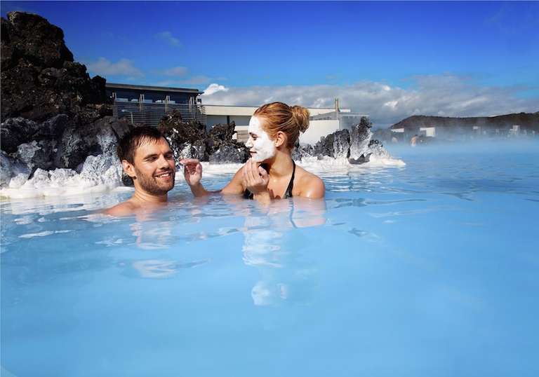
- Relax in the soothing natural hot spring of Stórihver and let the warm geothermal waters rejuvenate your body after a day of hiking.
- Explore the vibrant rhyolite mountains, such as Brennisteinsalda and Bláhnúkur, known for their colorful hues and unique geological formations.
- Take a short detour to Mount Hekla, one of Iceland's most active volcanoes, for breathtaking panoramic views of the surrounding landscapes.
- Capture stunning photographs of the ever-changing hues and patterns of the mountainsides as you hike through Landmannalaugar, Hrafntinnusker, and beyond.
- Experience the thrill of crossing glacial rivers, such as the Krossá River, carefully navigating the rushing waters using designated markers, or following the guidance of experienced hikers.
- Consider joining a guided glacier tour to explore the icy wonders of Mýrdalsjökull and Eyjafjallajökull up close. Walk on the glaciers, discover ice caves, and learn about the fascinating glacial formations from knowledgeable guides.
- Explore the enchanting Stakkholtsgjá Canyon for breathtaking views of the surrounding mountains.
- Climb up to high viewpoints like Valahnúkur or Útigönguhöfði for panoramic vistas of the glaciers, valleys, and the rugged beauty of the reserve.
- Discover hidden waterfalls, such as Seljalandsfoss and Gljúfrabúi, located near Thórsmörk.
- Witness the geothermal wonders of Hrafntinnusker, where you can observe steam vents, bubbling mud pots, and fumaroles. But to take caution and keep a safe distance from these geothermal features.
FAQS ON LAUGAVEGUR TRAIL
1. Is the Laugavegur trail difficult?
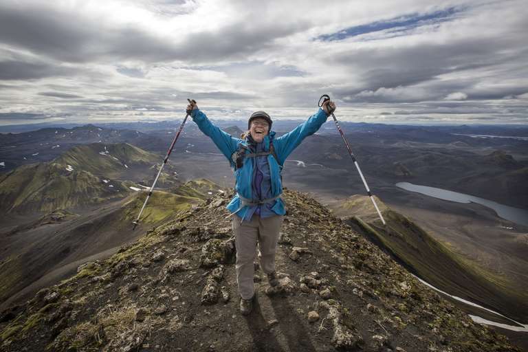
The Laugavegur trail is considered a moderately challenging hike. It involves varied terrain, river crossings, and steep ascents and descents. Hikers should have a reasonable level of fitness, be comfortable walking long distances, and be prepared for the physical demands of the trail. Proper training and preparation will enhance the overall hiking experience.
2. What are the risks of hiking the Laugavegur trail outside the recommended season?
Starting the Laugavegur trail too early or too late in the season can present challenges and potential risks. Early-season hikes may encounter snow-covered sections, making navigation difficult and increasing the risk of slips and falls. Late-season hikes may face increased river flow due to melting glaciers, making river crossings more dangerous. Hiking within the recommended season is best to ensure safer trail conditions.
Planning your itinerary for your hiking tour to Iceland? Our travel experts can help! Fill out our Iceland customized trips form to customize your itinerary.