Highlights
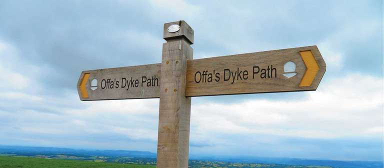
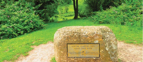
Walking the Boundary of King Offa’s Mercia
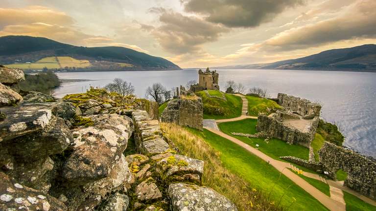
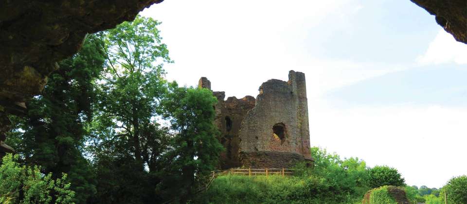
Historic Castles and Abbeys Dating From 1066
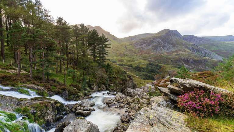
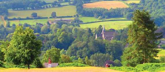
Border Country of England and Wales
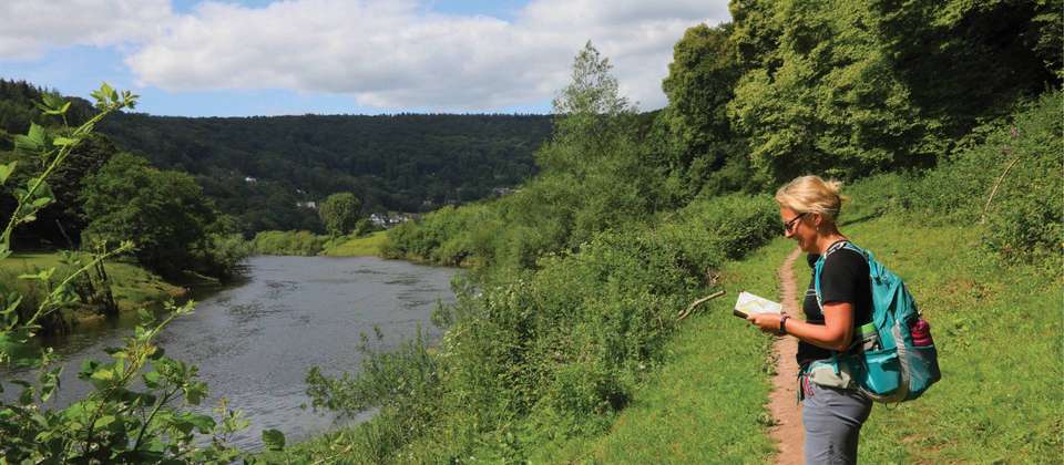
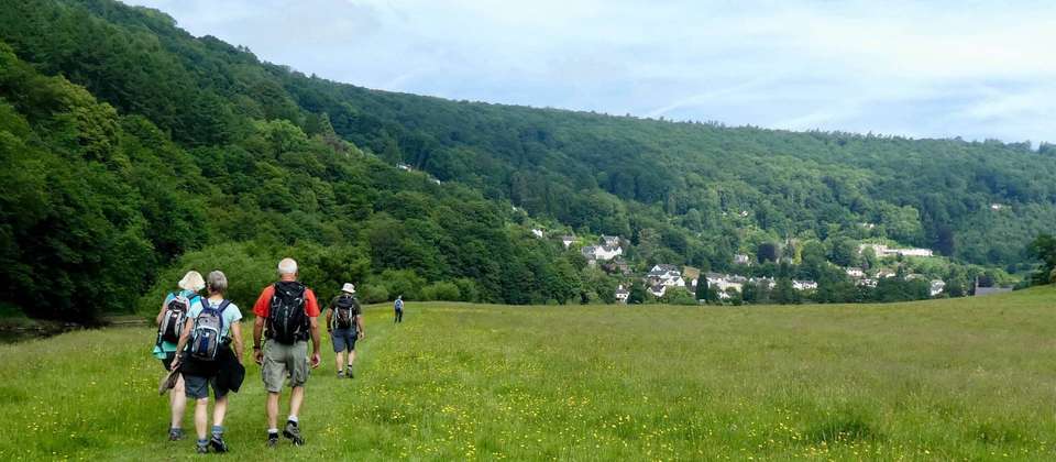
Walking in the Wye Valley
Itinerary
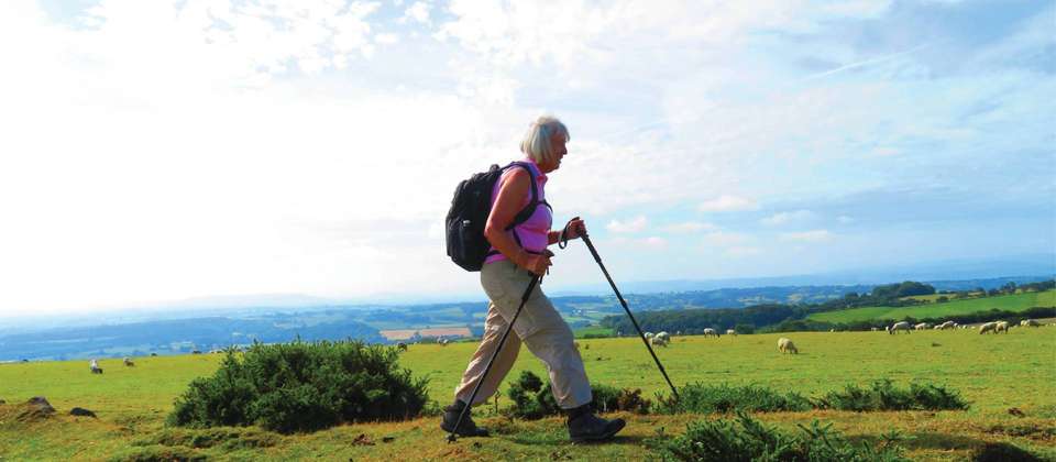
Trace the ancient borderlands of England and Wales on the Offa’s Dyke Path, an 8-day walking trip designed for experienced travelers and seniors seeking history and scenic beauty. Starting in Chepstow and winding to Knighton, this moderate trek covers the southern half of Britain’s longest archaeological monument, crossing between two nations more than ten times.
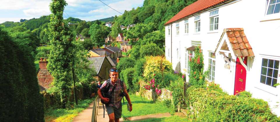
Follow King Offa’s 8th-century earthwork through patchwork fields, windswept ridges, ruined castles, and charming market towns. The path offers commanding views into valleys and mountains, with hedgerows, oak woods, and meadows alive with wildlife—look out for buzzards, the rare Red Kite, and perhaps even the mythical Welsh Red Dragon.
This tour package stands out for its blend of rich historical context and unspoiled rural landscapes, making it a journey packed with both cultural intrigue and natural splendor.
day 1 - Arrive Chepstow
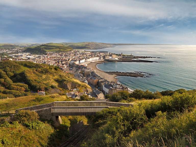
Make your own way to Chepstow. Located in Monmouthshire Wales, adjoining the border with Gloucestershire located on the River Wye, Chepstow is lovely to explore. If there is time, visit the ruins of Chepstow Castle, Town Gate and Wye Bridge, constructed in 1816.
day 2 - Chepstow to Monmouth 29km/18 miles
This morning, the route starts from the mud flats of the River Severn at Sedbury. The trail then climbs quite steeply in places up to follow the sheer valley side of the River Wye with some fantastic viewpoints. As you head towards the Tintern Abbey meander, you will notice that you are actually walking on the Offa' s Dyke. You can really marvel at the meandering river, the cliffs and the little settlements. Descend to Redbrook, a 19th century industrial village, or up and over the hills again to the famous border town of Monmouth.
day 3 - Monmouth to Llangattock Lingoed 21 km/13 miles
Climbing through boggy King’s Wood and then cross the Trothy River. The countryside becomes quite domesticated. The views to the north are dominated by the shapes of Skirrid and Sugfarloaf Hills. Stop in at Llantillo Crosseny village with its fine 13th century church. The village pub has features dating from the 15th century. The next stop is White Castle a 12th century Norman Castle built to protect the route from Monmouth into Wales. It is in a picturebook setting with intact walls and a little moat. Descending from the castle, bypass the village of Llanvetherine and undulate the last couple of miles along to Llangattock Lingoed.
day 4 - Llangattock Lingoed to Longtown 15.25 km/9.5 miles
The trail continues via Pandy where you leave the lowland farms and rivers and climb up onto the Hatterrall Ridge and into the Black Mountains. The ridge in the main follows the border of England and Wales and the edge of the Brecon Beacons National Park. Spectacular views all around.
day 5 - Longtown to Hay on Wye 23.3 km/14.5 miles
Morning steep ascent to regain the Hatterrall Ridge and then over the Cats Back and up to the highest point to the path near Red Darren at 2306 feet (703m). The ridge ends at Hay Bluff, a great northerly viewpoint towards Hay and the Wye Valley, the Hills of Radnorshire and also the Black Mountains to the west and parts of the Brecon Beacons. Next drop off the ridge and stroll via a set of five kissing gates into Hay on Wye, the capital of the second hand book trade. The town with its 12th century Keep was the site of the Anglo – Welsh power struggles in the 13th century.
day 6 - Hay on Wye to Kington 23.3 km/14.75 miles
Crossing the River Wye, today’s walk rises into the Radnorshire Hills. The walking undulates past sites of Roman encampments until you reach Glades try for a lunchtime pub break. For the last few miles today you have to climb up and walk along the Hergest Ridge amongst thyme, gorse and Welsh ponies. Eventually drop down to Kington, actually situated in Herefordshire with its 13th century church and the parallel lanes and long back gardens that may preserve the pattern of the strips in the former open field system.
day 7 - Kington to Knighton 22 km/13.5 miles
Some say this is the finest walk of the whole path, with Offa’s Dyke as your constant companion. First pass the highest golf course in England on Bradnor Hill. The trail then undulates spectacularly, but is never too steep. Beautiful westward panoramas open up across the Radnor Valley. On a clear day you get views 30 miles in each direction, over both the Brecon Beacons and The Malverns. The route climbs over a hill called Ffridd, before descending very steeply to Knighton (town of the horsemen) or Tref y Clawdd in Welsh (Town on the Dyke) as the town is on The Shropshire / Powys border. It is a very busy little market town. The market place has mainly 17th century shops and enough general entertainment to keep you amused for an evening.
day 8 - Arrangements end after breakfast
After breakfast make your way to the train station for your onward journey.

Get Trip Brochure & Exclusive Discount
Download a detailed PDF brochure and unlock an exclusive discount for this tour
What's Included
What's Excluded
Tour Availability
Select your preferred departure date and secure your spot
Loading availability...
Good to Know
Do you need help from our trip consultants?
If you have any question about this tour or need help with planning a trip, please do not hesitate to get in touch with us.
Our travel experts are ready to help.


Why Book with Bookmundi
Earn USD 52+ in travel credits.
Best price guaranteed.
No credit card or booking fees.
100% financial protection.
Carbon neutral tours.
25,000+ trip reviews, with an average rating of 4.8 out of 5.


